8 days / 7 nights

from € 650 Voli esclusi
CREA IL TUO VIAGGIOAlong the way, the Via Lauretana / Fixed dates 2021
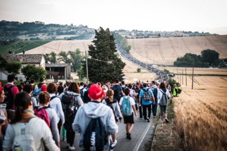
Via Lauretana is an ancient Marian pilgrimage route which linked Rome to the Sanctuary of the Holy House of Loreto since the Middle Ages. The road was destroyed in the sixteenth and seventeenth centuries, but was already used by travelers in the thirteenth century because it was a useful link between Rome and Ancona. Starting from the Capital City, the tour’s road initially coincides with the Via Flaminia, crossing Lazio and Umbria’s villages. From here the path can be defined, more properly, via Lauretana. The path runs along the Apennines pass of Colfiorito until Loreto. The importance of this road is due to the fact that it links two holy cities: Rome and Loreto, the first one being the site of St. Peter’s tomb and the other one being the site of the Nazarene House of the Virgin Mary. Also passing through the sanctuaries of Saint Nicola from Tolentino and of Saint Francis from Assisi, this street was also called the road of the sanctuaries. For this itinerary we propose a program in 7 stages, starting from Assisi, crossing the Apennines, walking through Colfiorito, Muccia, Camerino, Recanati (Giacomo Leopardi’s hometown), Macerata and finally Loreto, the pilgrimage’s destination. The route has quite long asphalted sections and is marked by purple stickers that with the inscription “Via Lauretana”. After the 2016’s earthquake, that hit some of the pilgrimage’s areas, the list of accommodation facilities and the route signs are constantly updated
Exclusive fixed-date departures – minimum 6 participants
Distance: 13 km - Travel time: 2h 45 '- Difficulty: easy
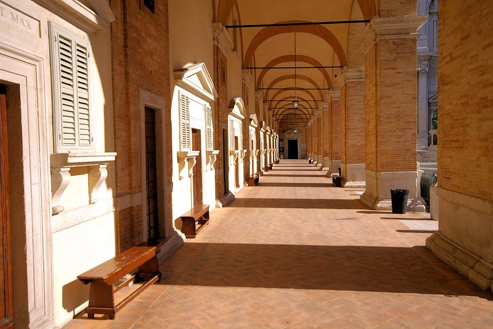
Meeting with our guide around 09.00 AM. The pilgrimage starts at the fourteenth-century gate of San Pietro, at the south-western entrance to the city of Assisi. As soon as you cross the passage, turn left onto the Porta San Pietro square and arrive in Piazza Bonghi. Continue in via Frate Elia and reach piazza San Francesco. Turning right into via San Francesco, the medieval via Superba that connects with the Piazza del Comune, after 120 m from the end of the ramp you will find Comacini Masters's lodge on the left. On the opposite side there is the Pellegrini's oratory, built in 1457 as a chapel for the hospital held by the Confraternity of Saints Giacomo and Antonio Abate. After 90 m you can see the portico of Monte Frumentario, with its seven lowered arches, on the site of the oldest public hospital of the city, founded in 1267. After the seminary arch, you enter the city, which has got roman origins; in the 18th century the nearby Benedictine monastery of Sant'Angelo di Panzo was converted into a bishop's seminary, which you can see on the right. The road, which changes its name to via Fortini, passes the piazzetta Verdi with the Metastasio theater and, following a pre-existing Roman route, joins via Giotto and continues on via Portica, at the end of which is the source of San Niccolò, rebuilt in 1926. Then proceed through Piazza del Comune, having on the left the thirteenth-century Torre del Popolo with the Palazzo del Capitano (1282) and the church of Santa Maria sopra Minerva, built on the structures of a temple from the first century BC; then you pass between the fountain of the three lions and the Palazzo dei Priori (1275-1493), on the right, entering Corso Mazzini. Turning immediately on the left you can quickly reach the New church, built in 1615 on the paternal house of Saint Francis, and financialized by Philip III king of Spain. Continuing instead along Corso Mazzini, you pass through the door of San Giorgio, a medieval construction in place of an older Roman door, then continue along Via Santa Chiara, enlarged and bricked up in the 14th century, reaching the square, that has got the same name, and that is in front of the Basilica
From Assisi to Spello: After passing through the Porta Nuova, after 55 m, take the SS 444 road on the right; when you arrive at the roundabout, go straight into via Madonna dell'Olivo and go straight for 230 m, then take via San Benedetto on the left. When the road, after the sports facilities, doubles, take the right turn that after 590 m intersects via Fosso delle Carceri and continues beyond. At the second crossroads, taking the left, you can connect with the Provincial road 251 and reach the abbey of San Benedetto al Subasio in 2.7 km, taking the right instead continue on via Borghetaccio, cross via San Vitale and enter via Fonte l'Abate and then keep left at the first crossroads, respectively central, left and central again at the following three triviums, then left again at the next crossroads.
After 1.0 km, when the road has taken the toponym of via del Gabbiano, you reach a large rural building complex, after which you turn right after 90 m, again in via del Gabbiano, then left at the junction that follows. The path winds its way southwards, then merges into via Renano, becoming more linear until it joins via degli Ulivi which you take to the left, entering the Municipality of Spello. Skirting Mount Subasio for 3.00 km, you arrive at the intersection with via Poeta which you take to the left and with which you will soon reach the Montanara gate, which leads to the town.
Length: 30 km - Travel time: 8/9 hours
Difficulty: Difficult
Total uphill: 1146 mt
Total downhill: 668 mt
Max altitude: 892 mt
Min altitude: 234 mt
After breakfast, departure for Colfiorito, a mountain hamlet near Foligno (PG), a town known for the early Christian basilica of Santa Maria di Pistia and the characteristic Convent of Brogliano.
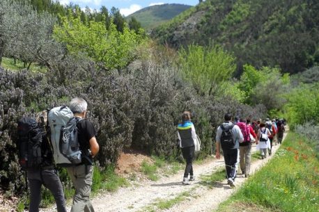
Before departure, it is recommended to equip yourself with bottles of water as there are no fountains for refreshment along the way. The difficulty level is high because the path is uphill and the road is paved only in the initial part. In the stretch between Belfiore and Colfiorito, you can admire a picturesque waterfall, but to see it, you must pass through a quite difficult stretch recommended only for trekking experts. Part of the route is not traced, so you will pass through the olive trees, but with the help of the GPS with the data already loaded you can easily identify the exact stretch. Before arriving in Colfiorito we will pass through a village called Pale. Arrival and accommodation at the Lieta Sosta hotel. Free dinner.
Length: 18 km - Travel time: 5 hours
Difficulty: Medium
Total uphill: 301 meters
Total downhill: 615 meters
Max altitude: 778 mt
Min altitude: 458 mt
From Colfiorito to Serravalle del Chienti: from the church of Santa Maria Assunta near Colfiorito take via Valle Verde, which runs along the right side of the temple, and then passes between the houses, and then merges into the Provincial road 96, through which in 1,15 km you arrive at the basilica of Pistia, a border sanctuary between Umbria and Marche. From here continue along the Provincial 96 up to the hamlet of Taverne which you cross by entering, on the left, into the Provincial road 50 which then continues parallel to the Foligno-Civitanova Marche freeway. Left the village, after 3.15 km the track joins the state road 77 which you take to the right and follow carefully for 720 m, and then you enter, right again, in via XXV Aprile which goes down to the hamlet of Castello. After passing the church of Saints Martino and Mauro, carefully return to Statale 77, again on the right side, for another 390 m, then take the left onto via I Maggio which soon intersects the Statale and merges into via Vittorio Veneto, winding along the center of Serravalle del Chienti, up to piazza Federici, from which via Santa Lucia branches off, with which you go up to the homonymous church.
From Serravalle del Chienti to Muccia: walk along Via Santa Lucia in all its length, thus descending to the Ospedaletto, or hospice for pilgrims that was active since the 13th century, which you find at the entrance to Corso Leopardi. At the following crossroads, take via IV Novembre on the left, then via Piave with which you exit the town, then turn right, passing around the yellow house, then left into the tree-lined avenue, parallel to the Statale 77 on which you enter after 610 m , in the direction of Macerata, crossing the hamlets of Bavareto and Gelagna Bassa where a cereal mill was active until the 1950s, from the 17th century, but probably was built and active from the 15th century. After this, in 990 m you reach the junction with a dirt road, which you take to the left and which, walking for another 2.25 km, climbs to the sanctuary of the Madonna di Col de Venti, in Muccia. From here, continuing along the road for 1.45 km, you reach the hermitage of Beato Rizzerio. Dinner and overnight in the hermitage.
** it is possible to make this stage also passing through Pievetorina instead of Camerino
Length: 30.5 km, Travel time: 8 hours
Min altitude: 250 mt
Max altitude: 655 mt
Total uphill: 855 meters
Total downhill: 967 meters
From Muccia to Pontelatrave:
In Muccia, walk along Piazza della Vittoria to the water mill where you go through the stream and go up the flight of iron stairs to the sidewalk at the level of the SP 256, then cross the intersection with the SS 77. Take the road that goes south abd leads you to the crossroads between Via Papa Giovanni XXIII and Via della Piane which you take on the left; following the path, you first enter the hamlet of Varano, then Giove, then cross the SP 209 to enter a dirt road, leaving it when it turns right, towards the villa della Maddalena: taking the path on the left, instead, you arrive in 1.20 km to the convent of San Francesco di Pontelatrave.
From Pontelatrave to Camerino
After passing the convent of San Francesco di Pontelatrave, after 320 m turn to the left. From here you can watch the mighty bulk of the castle of Beldiletto, an ancient fortress of the Da Varano family built by Giovanni in the second half of the 14th century, which Giulio Cesare transformed into a residence in the 15th century. After 280 m there is a Romanesque bridge: built in the 14th century on Roman foundations, it witness how Pievebovigliana, in the Middle Ages as in the modern age, is a crossroads; in fact, at the hamlet of Pontelatrave, the various routes converged which, through the Apennine ridge, came from the south of Italy, passing through Norcia and Visso. Having now reached the intersection with the state road 77, on the right side, in the direction of Macerata, there is the building formerly used as a post office, managed by the Cianni family in the 19th century. From here, after just 260 m on the state road, turn left and then left again at the following crossroads: this is the shortcut to San Marcello, a small hamlet in Camerino, which you can reach in 2.80 km; however, the road allows you to go around the town without entering it. From the hamlet of San Marcello go to Cignanello up to the intersection with the Provincial road 132 and carefully take to the left and leave after 620 m, turning right into the dirt road connecting with via Conti di Statte; after this, continue on the facing via arano, then pass via Baudana Vaccolini and go straight along Borgo San Giorgio, also passing viale Seneca up to via Leopardi. Then turn left onto the Provincial road 18 which in 400 m leads you in front of the Malatesta gate, from which you access the historic center of Camerino.
In Camerino: Walking along via di S. Giacomo, you reach piazza Santa Maria then take via Pieragostini to the right, then left into via Lili; when this flows into via XX Settembre, turn right again into corso Emanuele II, nearby the Palazzo Bongiovanni venue of the Municipality and reaching piazza Cavour. From the square, take via Veneziani on the right, then straight into via Ridolfini which takes you to the former convent of San Domenico going down the ramp that turns left and turning right at the intersection with via Betti. Here take via Antinori, the second on the right, which leads you to Piazza San Venanzio, which you can overlook from the basilica. From the square enter the Provincial road 18, heading north, up to the San Giovanni gate, after which, after 50 m, the Vicolo dei Fabbri opens up, slightly uphill, which winds between the houses and which in 70 m reaches the monastery of the Poor Clares, where the remains of Blessed Camilla Battista da Varano rest and where you can find hospitality.
From Camerino to Valcimarra
Continue along the Provinciale 18, you will reach the intersection with via Le Mosse which you take to the left; go straight over the first roundabout, then take the first exit on the right at the next roundabout, returning to the provincial road 18. After 1.40 km, on the left, you can take the road to the convent of Renacavata, on the place where it was previously located a domus hospitalis and where the Capuccini reform began in the 16th century. After another 625 m on the Provincial 18 there is another crossroads, with the Provincial road 22 which in 830 m leads you to the church of San Gregorio di Dinazzano where the sixteenth-century fresco of the Translation of the Holy House is preserved. Continuing instead in the direction of Macerata, after another 230 m, turn left to Piedilapiaggia, downhill, and you will reach the valley floor: about 2.30 km from the junction there is the former hospital complex with the church, which today is a private house, founded by Venanzio di Giovanni, hermit of Statte, in the second half of the 15th century. After a further 2.70 km, the road joins the SS 77 at Campolarzo, a hamlet in the municipality of Caldarola. From here the itinerary coincides with the one passing through Polverina.
From Valcimarra to Caldarola
From the Madonna del Sasso descend towards Valcimarra Alta, taking left at the first crossroad, and again at the second and third. When the road merges into the tangent to the four lanes, you can turn left to reach the village of Valcimarra Bassa in 500 m, where the building of the San Giorgio hotel, post house, remains; otherwise continue to the right, skirting the Borgiano lake for 1.61 km, then at the crossroads take the central road that goes to the castle of Pievefavera, passing it, and then joining the Provincial road 502.
After just 300 m you leave the provincial road, turning right at the first crossroads, and right again at the next crossroad with via Rimessa which, after a wide bend, enters via Pallotta, at the foot of the castle of Caldarola; here you will find the collegiate church of Saints Gregory and Valentine.
From Caldarola to Belforte del Chienti
From the collegiate church of Saints Gregorio and Martino, walk along via Pallotta to the end; at about half of its length, at the corner with via Durante, on the right, there is the Municipal Theater. Piazza Vittorio Emanuele II opens up at the next intersection with the Provincial Highway 502, overlooked by the collegiate church of San Martino and the sanctuary of Santa Maria del Monte.
Once you have taken the Provinciale 502 on the left, walk to the roundabout, then take the second exit on the right, entering the Provincial road 7 which after about 2.30 km passes under the State Road 77 and, after another 640 m, intersects with Via Santa Maria , at the foot of the Belforte del Chienti castle. After crossing the road, take via Angelucci which you follow until the crossroads with via San Giovanni. Keep going, in the small road facing you, which runs tightly between the houses, at the end of which you can continue along the short stretch of path; after 140 m this joins via Provinciale which you take to the left and which after two back turns takes on the toponym of via Scalette. At the crossroads then turn right into via Santa Lucia which soon brings you to the town gate of the same name, from the 18th century, after which in just 150 m you are in Piazza Vittorio Emanuele II where the monastery of San Lorenzo delle Clarisse is located, in 1890 to replace the old one which, founded in 1648 and closed in 1861, stood behind the Town Hall building in Piazza Garibaldi where you pass another 40 m. Overnight at the BB il Villino, shuttle to the restaurant where you can dine (dinner not included in the fee).
Length: 9 km - Travel time: 2 hours
Total uphill: 88 mt
Total downhill: 212 mt
Difficulty: easy
From Belforte del Chienti to Le Grazie
Leaving Piazza Vittorio Emanuele II, turn right into Piazza Garibaldi, passing by the church of Sant’Eustachio, then enter via Leopardi, nearby the church of the Santissimo Crocifisso. When the road joins Via Principessa Margherita, take the stairs that lead you in front of the church of San Sebastiano.
From here it is possible to "cut" via a short gravel path that flows into the road that leads to the underlying village of Santa Maria: after 217 m downhill you cross the provincial road that you cross by entering a pedestrian path that cuts through the plot of land taking you in front of the parish church that gives the village its name, otherwise known as San Pietro. Continue along via Ciappi as far as via Santa Maria, after that the road takes the toponym of via Loreto; 85 m before taking the bridge of the same name, with which you pass under the highway, you will see in the center of the green area on your left the triumphal arch that the Community of Belforte erected in honor of Pio VI, traveling along the via Lauretana in 1782. Beyond the bridge it continues along the gravel road, until it resumes via Santa Maria. Follow the road for 1.50 km until the roundabout near the Le Grazie viaduct. Taking the second exit, walk for another 1.10 km until you reach the church of Santa Maria delle Grazie.
From Le Grazie to Tolentino
After just 205 meters, turn right into via Mattarella, which runs along the lake, then there is a sharp curve, towards the historic center. Passing through the countryside, we get to the Pianibianchi district which runs parallel to the river, up to the Devil's bridge. After crossing the Chienti, take viale Filzi on the left, and then again on the left to via del Vallato at the junction that follows. At the intersection with via Osmani, which you take to the right, you reach the iron staircase through which you go up to viale dei Cappuccini, then you enter via Adriana passing through the door that gives it its name. After 55 m, turn right into traversa Adriana, then left into via delle Caserme. Before arriving in Piazza Maurizi, on the right, there is the church of la Carità, attested since 1233 but probably built on the 11th century. The main entrance portal is noteworthy. Overnight in BB, dinner not included.
Travel time: 7 hours
Length: 33.71 km (6 of which are recommended by public transport)
Difficulty: Medium
Total uphill: 811 mt
Total downhill: 739 mt
Max altitude: 414 mt
Min altitude: 128 m
UPDATING TEXTS AND NOTES:
- mainly asphalt ground;
- the first part of the gravel path between Colle Redentore and Divina Pastora becomes muddy in case of rain;
- you can get to the Abbadia di Fiastra through an access located near the Enel power plant, walking along a rustic ground that becomes muddy in case of rain;
- it is recommended to travel the stretch from Abbadia di Fiastra to Macerata by public transport, thus bypassing a stretch of road of about 1 km with a high density of vehicular traffic. Tickets can be purchased directly at the Information Office in Abbadia.
This stage develops almost entirely in the wide valley created by the Chienti river; only in the last kilometers there is the climb to reach Macerata, located on the ridge, which determines a change of pace and landscape. Following the right bank of the river, less man-made, where unfortunately all the roads have been asphalted (there were large stretches of gravel road until not many years ago). The countryside, tidy and well cultivated, is nevertheless crossed with pleasure. In the central part of the stage you have to deal with traffic, but you can move almost anywhere on the sidewalk or on side streets. The climb to Macerata takes place on secondary and little-frequented roads (however, you must be careful), with large shaded areas. Before reaching the outskirts, you cross an extensive residential area. The deviation to the splendid abbey of Fiastra is worth the extra hour of walking that it entails overall (plus visiting time ...).
Signs: red and white signposts of the Via Lauretana (signed "VL").
From the Convent of San Nicola, take via Bezzi on the left downhill and then via del Ponte, which leads to the other side of the Chienti river, across the Devil's Bridge. After the bridge, turn left, then left again, on provincial 125, following the signs for the abbey of Fiastra. Follow the SP 125 for almost 6 kilometers, passing twice under and once over the four-lane road. Then turn left, following the signs for Pollenza station until you reach the crossroads which turns left onto the freeway. Instead, continue straight along a narrow asphalted road.
About 3 kilometers after the crossroads, take an overpass to the left, after which you reach the intersection with provincial road 78. Take the SP 78 on the left, paying attention to the heavy traffic. After passing the Chienti, continue straight ahead, both at the roundabout and at the deviation, reaching the state road 77 at the height of the town of Sforzacosta. Follow the state road to the right for less than a kilometer; at a roundabout, turn right onto state road 485 (towards Civitanova Marche and Corridonia). Follow it for about a kilometer and a half, moving onto via Giovanni XXIII, a parallel service road to the industrial area. At the end of the road (closed) you return to the main road (watch out for the ditch!) And continue eastwards; then turn left after 300 meters along the Pieve municipal road (road signs for Ancona and Villa Potenza). After a first uphill stretch, after about 700 meters, turn right onto the Corneto municipal road; after a first stretch of plain and downhill, the road winds its first uphill part, then merging into via Cincinelli, at the beginning of the town of Macerata. You then meet a roundabout, after which via Cincinelli continues downhill, passes under the railway, and meets via Beniamino Gigli, which you take to the right. Via Gigli climbs for just over 300 meters, until it merges with corso Cairoli. You go through it all, up to the roundabout of the Sferisterio. You enter the city through the monumental gate and via Fratelli Ciccarelli. Follow it to the intersection with via Lauro Rossi, which you turn right. Then continue along via Matteo Ricci; cross via Gioberti and take the pedestrian via dell’Erta, at the end of which you turn right and you will find yourself in front of the facade of the cathedral of Macerata and the end of the stage.
Detour to the abbey of Fiastra
After the crossroads, proceed for just over a kilometer, turning right and going up again in just over a kilometer on the provincial 125 which you take to the left. After about 400 meters, take state road 78 on the right which leads in 700 meters to the abbey of Fiastra, through a pedestrian passage on the left. Go back along the same road, but at the crossroads, continue right on the main road, re-entering the previous route in just over 2 kilometers.
Length: 24 km, Travel time: 7 hours
Altitude difference uphill: 600 m
Altitude difference downhill: 770 m
Difficulty: medium
Ground: asphalt
The last stage of the Via Lauretana has varied elevations: steep descent from Macerata; tiring pass of the hill of Recanati and finally climb of the hill of Loreto: the flat sections are few. But the asphalt is almost everywhere. On the hottest days, the combination of uphill and asphalt can make the journey very challenging. Crossing the town of Recanati and arriving in Loreto, however, offer pleasant stretches in the shade, as well as inviting reasons to stop, in churches and historic buildings. Throughout the rest of the route, large stretches of well-cultivated countryside alternate with scattered houses and small towns.
Leaving Macerata, the variant to Villa Potenza repeats the initial route of the annual night pilgrimage to Loreto organized by Comunione e Liberazione. The other variant, leaving from Recanati, invites you to take the state road 77, the historical route of the Via Lauretana in modern times.
Signs: red and white signposts of the Via Lauretana (signed "VF").
From the cathedral (piazza Strambi), go down in via don Minzoni, which runs around the apse of the church, then turning right downhill and exiting the walls. Cross the ring road (if the underpass is closed, be very careful), taking Borgo San Giuliano downhill, which after 400 meters turns right into via della Pace. Continue downhill; about 200 meters after the parish church, at a small clearing, turn left into via Fonte della Quercia, which descends until it crosses via della Pace again after 400 meters. Cross the main road and take a small road (contrada Pace) which descends to the bottom of the small valley and crosses the ditch on a small bridge. After the bridge, continue to the right, skirting the ditch for about 350 meters. Then turn left into the Fonte San Giuliano district, which goes north for almost 2 kilometers. The road returns to the main road (Strada Provinciale Potentina), which you take to the right on a slight slope. After just under 300 meters you reach a crossroads, where you turn left (road signs for Montecassiano and Recanati) and quickly descend towards the Potenza valley floor. Warning! The traffic is not heavy, but the road is narrow and the vehicles pass quickly. After a kilometer of steep descent and another kilometer of plain, you cross the bridge over the Potenza and enter the town of Sambucheto, merging, through a roundabout, into State Road 77, which you take to the right. Leave the parish church on the left and, after about 300 meters, turn left towards the north, taking via Santa Croce (at the sign for the beginning of the village and the beginning of the municipality). After a little over a kilometer heading north you reach a crossroads where you turn right heading east (signposted for Santa Croce). The road continues more or less straight and flat for just under 2 kilometers. Immediately after a short climb the road curves 90 ° to the left. A hundred meters later, turn right, starting to take a dirt road that crosses a ditch and climbs in 2 kilometers to the Costa dei Ricchi intersection located right on the crest of the hill. Continue (signs for Recanati) descending steeply towards the valley floor (Fosso Ricale) and going up equally steeply to the convent of the Passionist Fathers, which can be reached immediately after a crossroads.
From the convent, continue along via Passionisti, which you follow all the way until you cross state road 77 again, which you follow for almost 200 meters, turning left into via Le Grazie, which climbs steeply. At the end of the climb, continue straight along via Sweepstakes, which leads to via del Risorgimento. Take it on the right, then continuing uphill to Piaggia Castelnuovo. Cross via Monte Conero to take a staircase on the other side of the road, which leads to via della Residenza, then to via Falleroni, which you take to the left (turning right you reach Piazza Duomo instead). Continue for just over 50 meters, turning left into via Mazzini, which in about 150 meters leads back outside the walls. Cross via Cesare Battisti and continue downhill along viale Monte Conero. At the height of the convent of San Francesco, the downhill road becomes Via Loreto, which in 700 meters leads to a roundabout. Leaving a newsstand on the left with a crucifix, continue slightly downhill along the provincial road 105. At the first bend, exit the provincial road and continue straight (signs for Loreto). After about 2.5 km you will come to a roundabout in correspondence with a country church. Continue straight along via Brecce for just over 1.5 kilometers, then turning right onto via Impaccio, at a semi-bend. Via Impaccio goes up the hill of Loreto for one kilometer. It enters via Costa d’Ancona (29), which you turn right. In just over 100 meters, after a flight of steps, you reach via Brancondi, turning left towards Porta Romana. You then enter the center of Loreto, shortly arriving in Piazza della Madonna, at the sanctuary of the Holy House at the end of Via Lauretana. Overnight at the hotel, free dinner.
Release of the room and final greetings.
Tariff per person, starting from:
| Departure | Double |
|---|---|
| From 7 March 2021 to 17 October 2021 | € 650 |
Notes
(B / L / D): B = breakfast; L = lunch; D = Dinner
2021:
* For some departures in high season, a supplement may be required.
Accommodations considered, or similar:
The tariff includes
The tariff does not include
Duration: 7 days / 6 nights
from € 190 - Voli esclusi
Duration: 8 days / 7 nights
from € 290 - Voli esclusi

Duration: 8 days / 7 nights
from € 650 - Voli esclusi